2002 Sequoia/Kings Canyon Hike - Day 4
Ranger Meadow to Bearpaw Meadow - 11.5 miles
<-Previous Day]
[NextDay->
[Day 0]
[Day 1
[Day 2]
[Day 3]
[Day 5]
The hike over Elizabeth Pass started out nicely enough. David & Dick had hiked it a couple of times before and referred to it affectionately as "Elizabitch Pass". On the other hand, on those previous ascents, they had gotten late starts & had to hike all the preliminary stuff in the heat of the late morning. Wishing to avoid that, we got up early & hit the trail by 7 (well, Dick was on the trail at 7 - I got on the trail more like 7:07 or 7:08 - as usual, I was the slowest getting packed up).
The first 40 minutes of the hike took us up a moderate grade to Upper Ranger Meadow. There were a couple of people camping there, & they informed me that Dave & Dick had come through about 5 minutes before. After that meadow, the greenery thinned to scrub, and taller grasses next to the creek. I soon saw D&D about 1/2 mile ahead of me on the trail. At this point, the sun hadn't risen above the ridge line to the east yet, so it was still nice and cool.
I caught up with D&D about 1/2 mile below a waterfall. We stopped to pump some water, the last we pumped before the pass, but we really could have pumped it as much as a mile further along the trail, as we kept crossing the stream. As we looked up from our water pumping break, the pass was still blocked from view, and it looked pretty steep on both sides, with no clear trail. Dave & Dick knew from the past that it went up the left (east) side of the valley & then across the waterfall, but you couldn't pick out a trail even knowing that. We saw several hummingbirds buzzing around what vegetation there was, which was
After a steep, switchback trail up the left side of the canyon, we cut through a notch in the rock and up onto the ledge at the top of the waterfall. This was one of the funner creek crossings, near as it was to the waterfall. Just past the crossing we stopped for a break. While we were kicking back, Dick spotted a marmot coming out of the bushes. I went for my camera, but this critter was a bit more wary than our doe friend from Thursday night. I tried to get a picture of him, but I couldn't really get close enough. We saw one or two other marmots on the trail, but they were equally wary.
Now we were past all the easy climbing & into the sun & the steeps. If you're a skiier, you can visualize climbing up the top part of Mammoth or the double black diamond section of your favorite resort. Like doing switchbacks for a couple of miles up Scotty's or Climax. Eventually, the pass became visible, and the last part of the trail looked intimidatingly steep. We quickly closed the distance between ourselves and that last push. Even though we were tiring a bit at that point, we forged ahead up the last steep stretch to the pass. It was just past noon.
Elizabeth Pass has marvelous alpine peak views in all directions. It's at 11,360 feet, but after being above 7000 feet for 3 1/2 days, we were acclimatized enough that the altitude didn't really affect me. We had a leisurely lunch, interrupted only briefly by a couple of finches that flew tightly over the pass, buzzing close by our heads (I don't think they expected anyone to be up there :-).
We were kind of lighthearted heading out of the pass, as we were under the impression that the hard part of the hiking was over for the day. It should just be a descent of ???3000??? feet over 6 miles & into camp. What we didn't plan on was that it was actually a descent of ??3500?? feet over 4 miles, then an ascent of ??1000?? feet over a mile and a half, then a descent of ??500??? feet over the last half mile.
The first part of the trail was as steep as the uphill side, but on this side it was loose scree, meaning loose, sliding footing. Not exactly what you want when you're carrying a backpack. After that, the trail went almost straight down the contour of the hill, zigzagging a bit but following a fairly steep course. The trail wasn't always easy to follow, so it was well marked with ducks, but it became a cycle of 1. find the next duck 2. walk to it. 3. lather, rinse, and repeat.
We finally got off of that part of the steeps, and came back down to a creek, where we stopped for water. At this point our feet and legs were pretty tired & sore (from the descent more than the climb) & it was getting pretty hot for the first time on the hike. We hadn't seen shade since 9 or 10, and it sure would have been welcome at this point. This time, for the first time, Dick followed my example and poured some water from the creek over his head for a cool-down.
A short walk after our water stop, we could see the bottom of the valley & the Kaweah River below... a long way below. We started down a long stretch of switchbacks through manzanita bushes & occasional patches of wildflowers. The flowers were nice, but more shade would have been much more welcome at that point. Soon enough we reached the valley floor & flopped down on the ground to rest. I wanted to go cool my feet in the river, but it looked pretty swift & treacherous at that point, so I passed on the opportunity. We were exhausted, but we knew we only had a couple of easy (yeah right) miles to go into Bearpaw Meadow.
Two miscalculations made this day lest pleasant than we anticipated. The first was mine -- using the small map I had, I estimated the total mileage for the day at 10.3 miles. Unfortunately, my map left out a small stretch linking two points that added 1.2 miles to that & brought it up to 11.5 miles. The second miscalc was for the last stretch into Bearpaw Meadow. We knew it was 2.1 miles, but David checked the topo & told us it would be a 500 ft altitude gain and then some loss. It turned out to be a 1000 ft gain & then some loss, much steeper, and much more painful to already sore feet and legs.
As we got close to camp, I was pretty beat, but I didn't want to take off my pack for another rest break, as I didn't know if I'd have the energy to put it back on at that point. As I was plodding along, I heard a loud noise ahead. I turned to David & said, "we're either close to Bearpaw, or there's a big animal up ahead." I went down one more switchback & there it was. A bear.
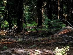
My first reaction was to take out my camera & turn it on. Then I turned to David & said, "Hey look, a bear." I turned back & the bear had heard me (or more likely smelled me). He turned & started to scamper away. My camera just barely had time to lock focus & shoot before he got away. I didn't have time to put on the telephoto lens or sneak up closer, so this shot's not as clear as most of the other animal shots I took, but it was still cool to not only see, but get a picture of a bear. I tromped the last half mile or so into camp tired but happy.

The camps at Bearpaw Meadow were fancy, with fire rings & cut up logs for tables & chairs. We stopped at the first campsite we came to, as it looked spacious enough for 3 tents. Sitting right next to the site when we arrived was a deer. As with the doe we had seen two nights before, this one was extremely tame & didn't run away even when I came within about 5 feet of her on my way down to get water. I changed out of my sweaty clothes, & started boiling water for dinner. It was just after 6:00.
We were all really tired, so we basically crawled into our tents after dinner & cleanup, but it was a really warm night, so it was difficult to get to sleep. Eventually it cooled down a bit and I drifted off to sleep, my snores drowning out the sounds of nosy deer shuffling about & pine needles dropping from far above onto my tent. wildlife: bugs, hummingbirds, finches, marmots, deer, bear
|


